About the Project
I was approached by a senior volunteer and coordinator at the Ballarat Tram museum to create content for their new interactive displays.
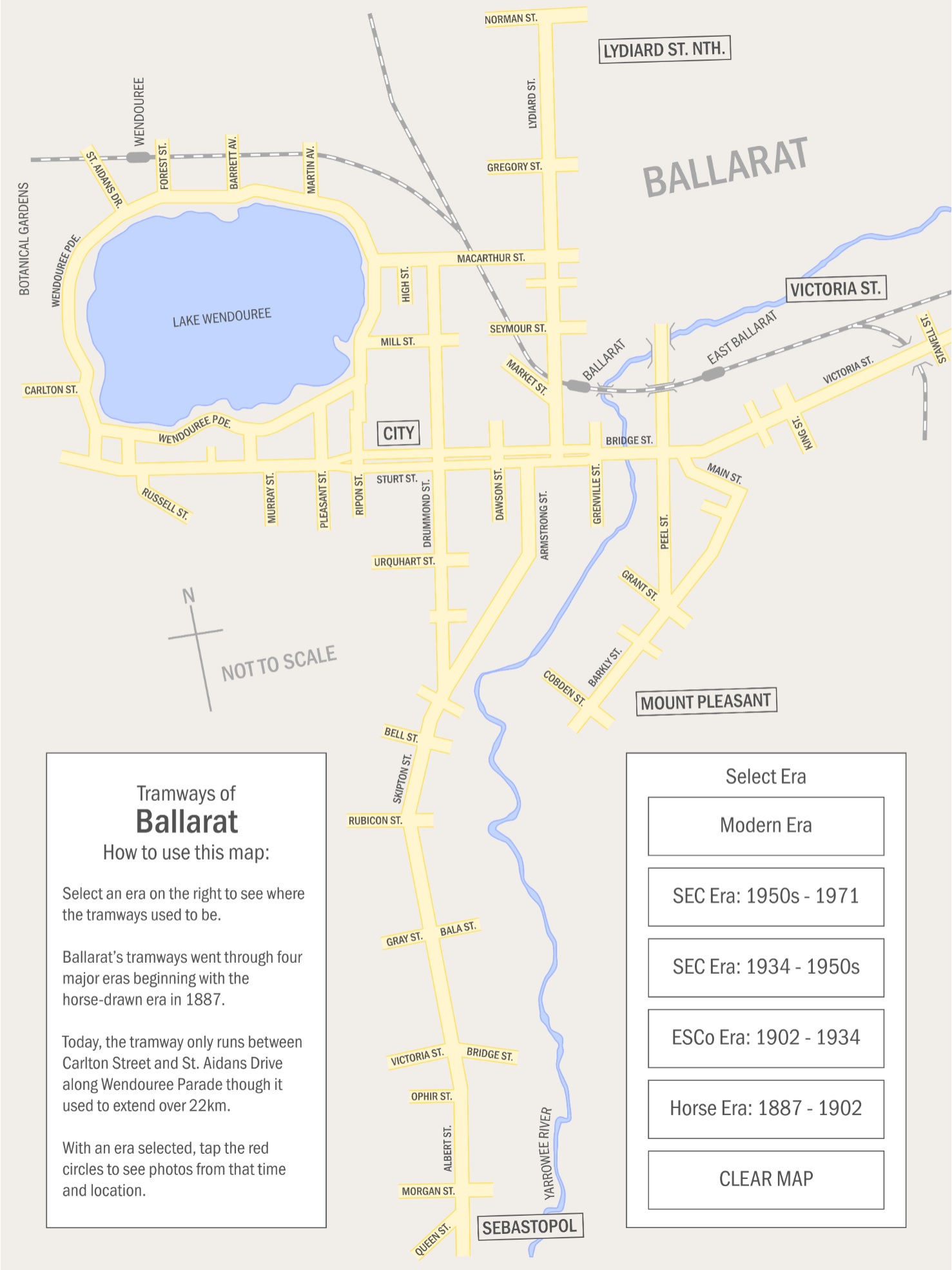
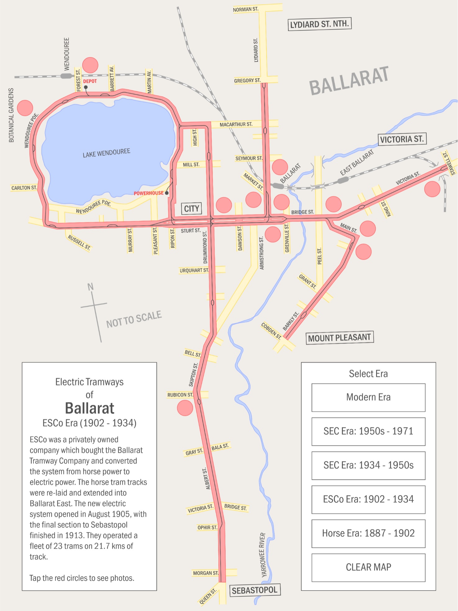
Create an interactive map of Ballarat that educates meseum-goers on the evolution of Ballarats tramway over 137 years and 5 separate eras.
Engage the audience in an exciting and easy way.
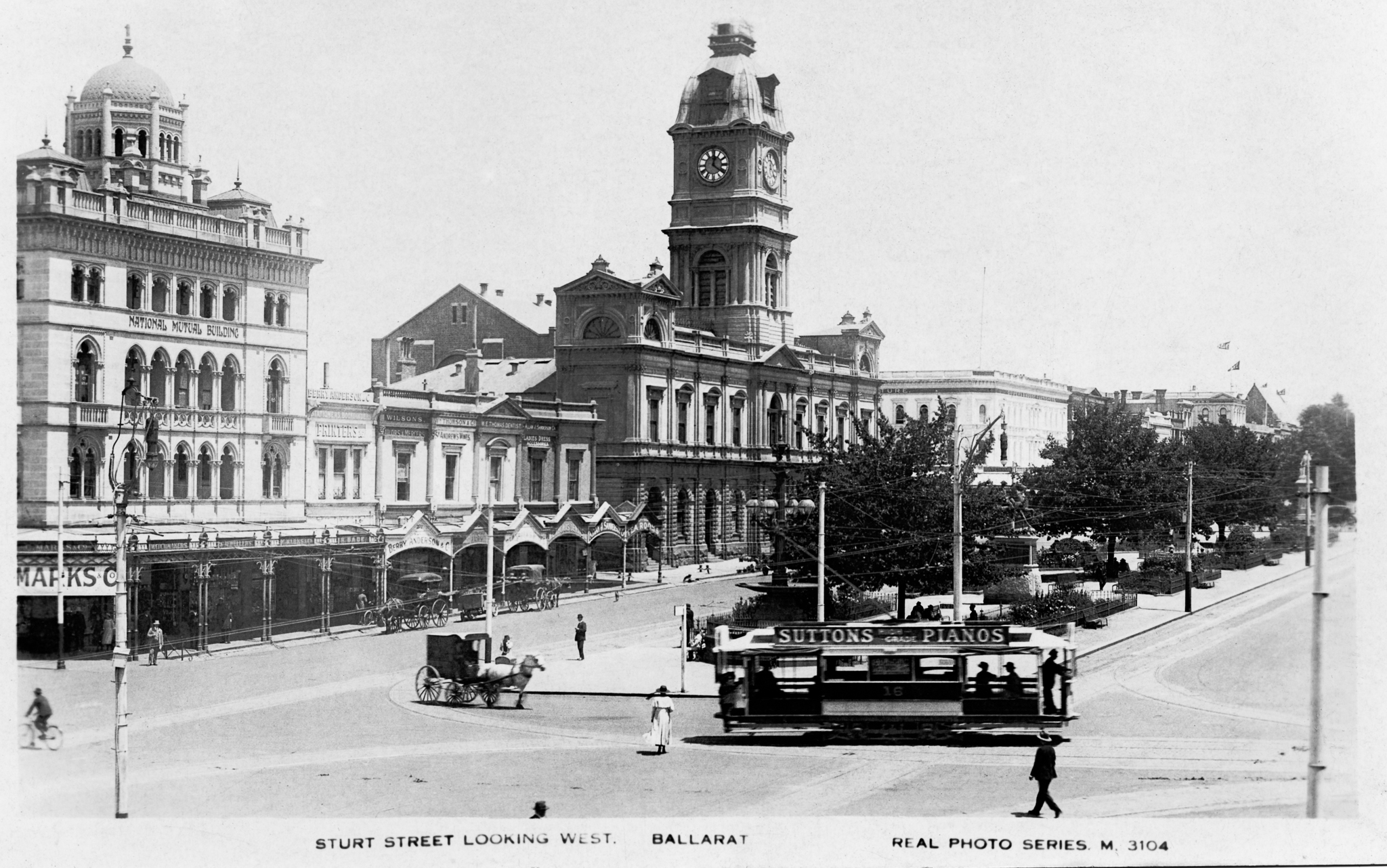
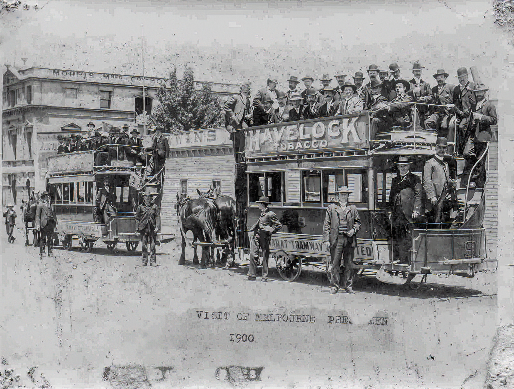
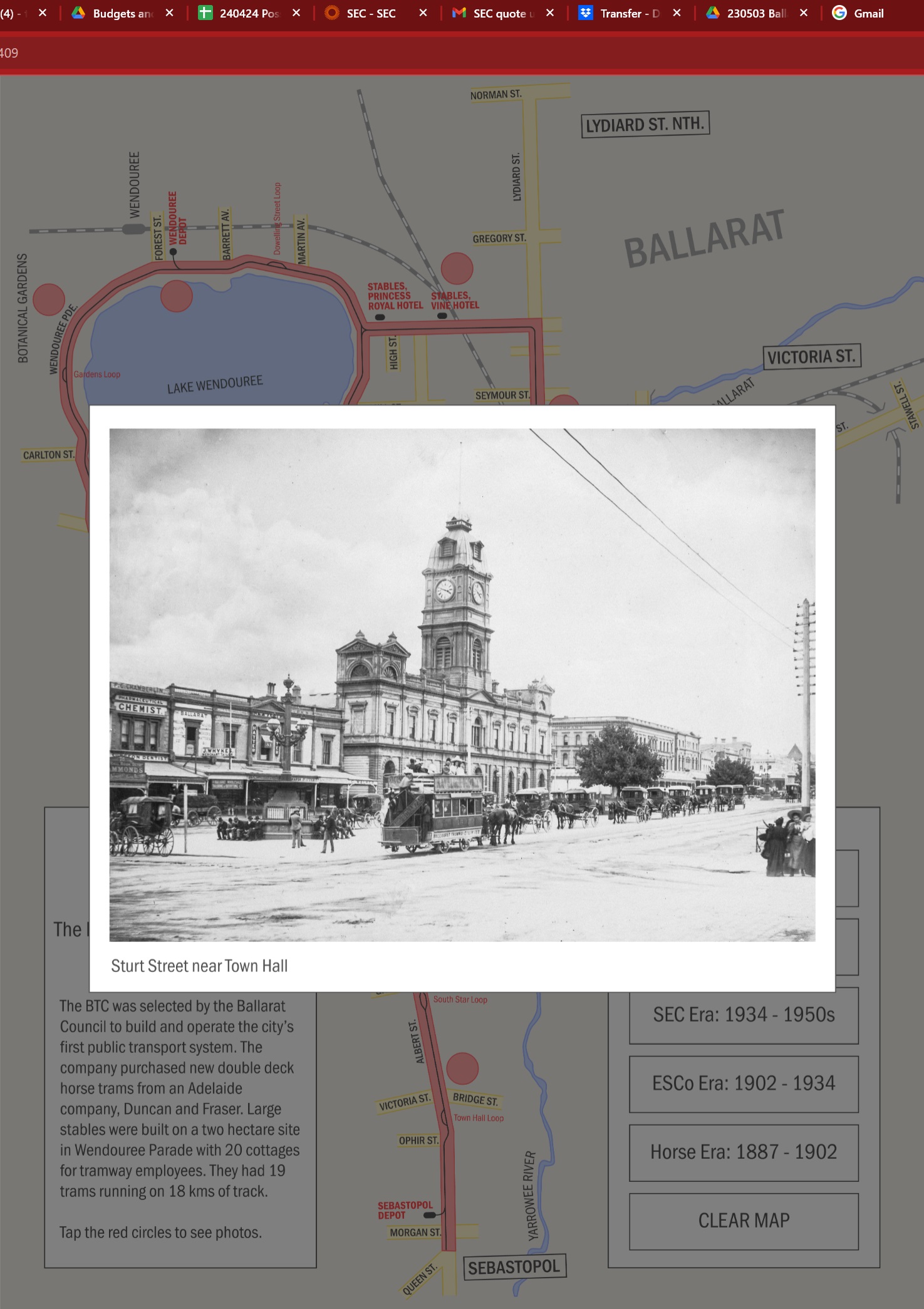
Help showcase the best photos from the museum’s considerable archives.
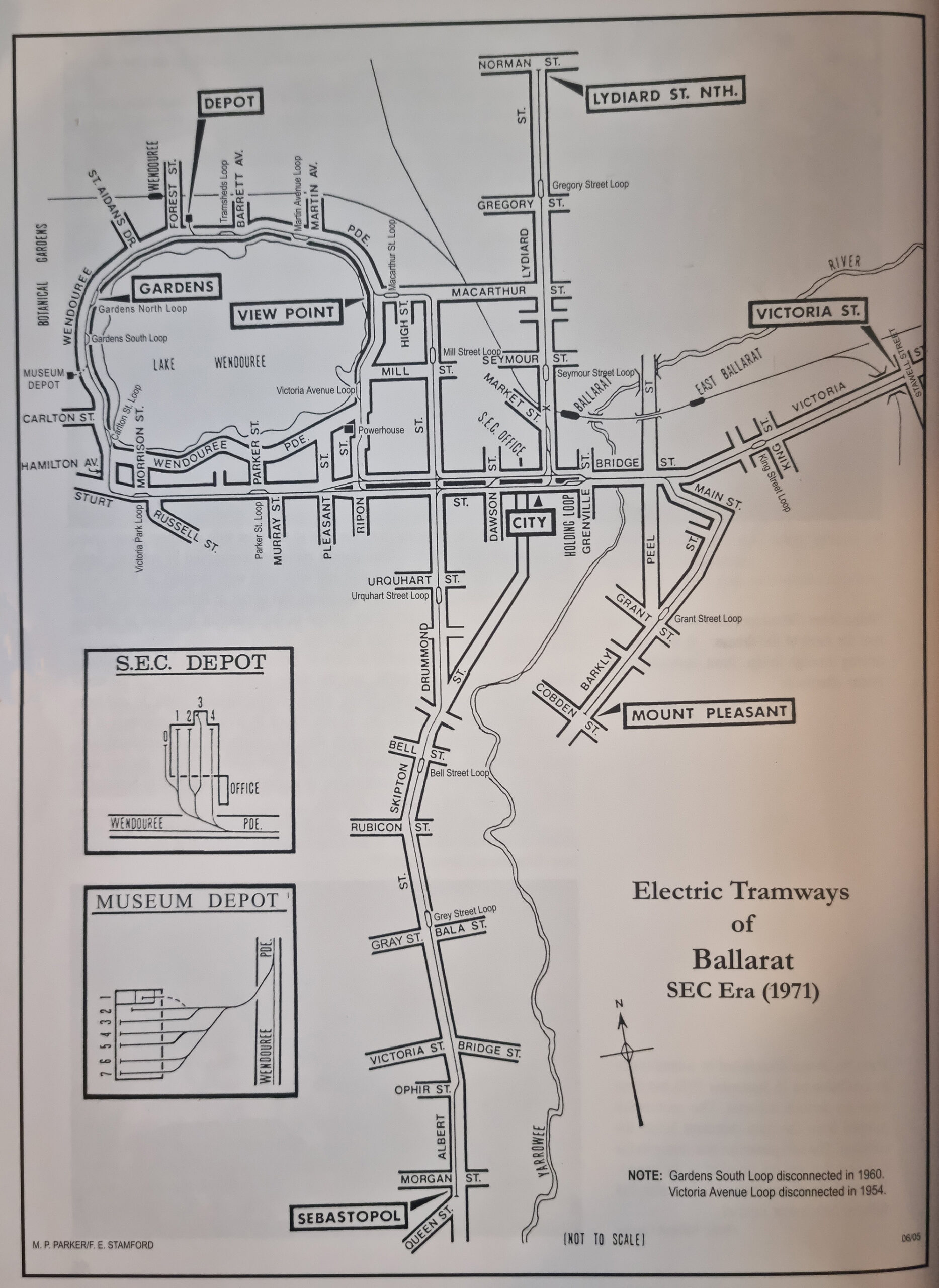
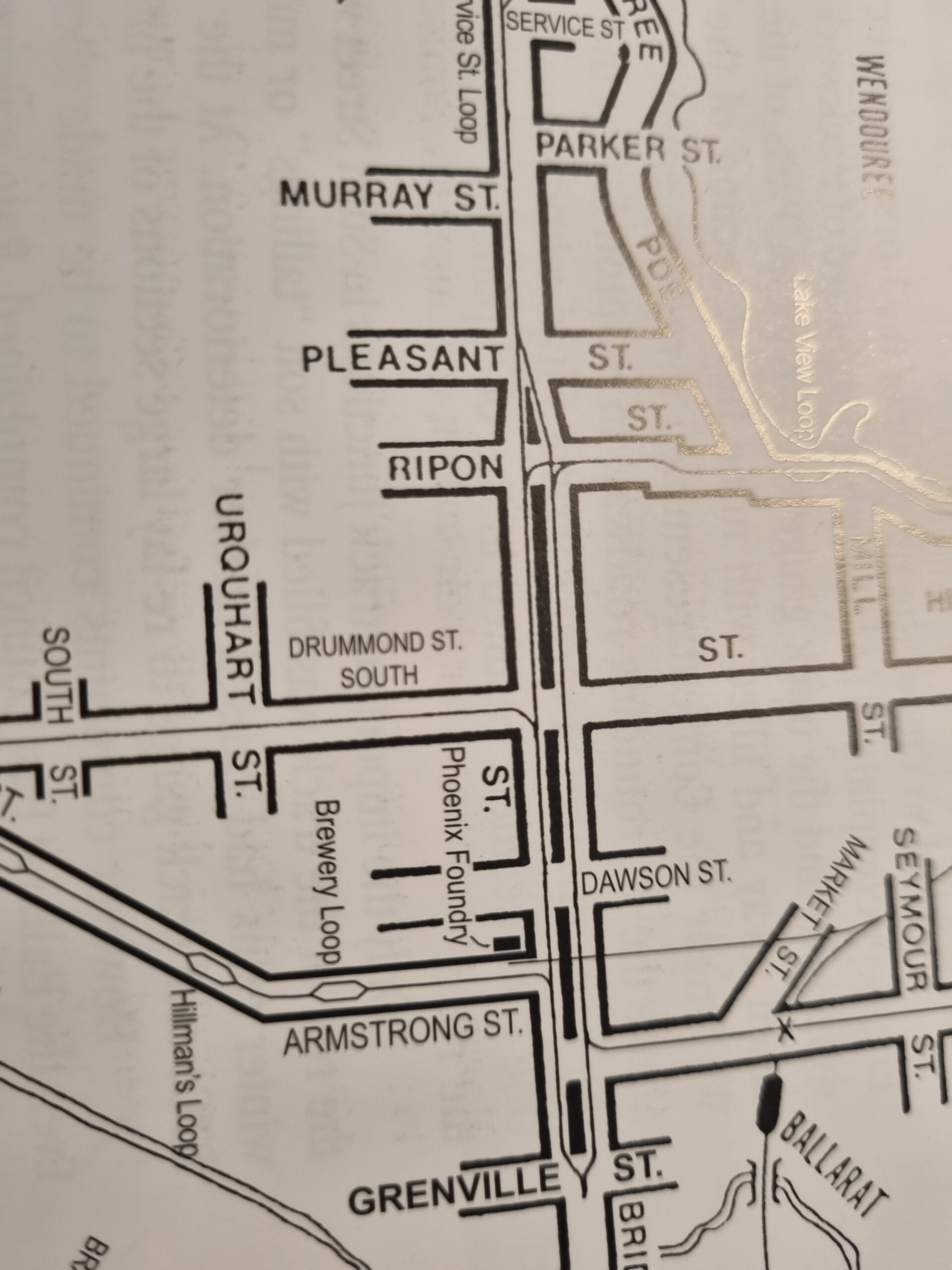
I was provided with 67 photos of Ballarat locations illustrating the changing Trams and Tramway, and captions written by the museum. I was also provided with a book, The Golden City and its Tramways by Alan Bradley, published in 2005 by the Ballarat Tram Museum.
With permission, I recreated the maps (M.P. Parker/F. E. Stamford) digitally and updated the style for modern audiences who use online maps daily. The detail in the maps was considerable, showing the locations of the tram tracks themselves including every tram loop and interchange. I decided early on that this detail needed to be preserved – omitting only the layout of the tracks in depots. As it transpired, many standard design aspects proved to be more difficult than expected: decisions about colour, edge-rounding, name placement, water representation, outlines, etc. all had significant impact on the readability and what would be acceptable in modern map aesthetics. My brief foray into cartography was a fascinating challenge.
Lastly, I chose to program the map in Adobe Animate. This was due to it’s integration with Illustrator, it’s established web-integration with html5, and my existing coding experience. In the future, I might use Rive or another software for interactive programming, but I knew this program would work with Adobe Animation html5. A limitation of this was how difficult it would be to return to the design stage after beginning the programming. I informed the client and made sure all decisions and exports were approved before continuing.
A major consideration concerned the final export filesize. Running on an off-site web-server I spoke to the developer of the museum’s interactive display about the process used to cache the content. Content is cached and infrequently clear so I decided maintaining photo resolution was more important than load-times. The final export was 274MB. It took several minutes to load the first time, and was instant thereafter.
In all, this was a fascinating project that I felt privileged to a part of. It brought me closer to my hometown of Ballarat and gave me the opportunity to delve into map design. Lastly, I was able to re-enter the world of interactive design which I have pursued since.
That is awesome!!!! It is so clever with the photos ... it looks great.
Cherie Brown - Developer Ascet Digital
The Ballarat Tramway Museum would enthusiastically recommend Tom Bell Creative as a highly skilled graphic designer.
Peter Waugh - Facilities Manager Ballarat Tramway Museum
Following the success of the Interactive Tramway Map I was asked to make a follow up interactive map of the museum itself which can be seen below. This map was to ensure that visitors to the museum were aware of everything on offer and could easily navigate the museum’s large, newly renovated space. I incorporated 3D design (using Blender) based on the architectural drawings created for the museum.